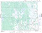
Maps showing Poplar Island Lake, 28-2-W, Manitoba
Poplar Island Lake is a Lake located in 28-2-W, Manitoba and has an elevation of 231 meters.
- Latitude: 51° 24' 24'' North (decimal: 51.4067000)
- Longitude: 97° 41' 58'' West (decimal: -97.6993999)
- Topography Feature Category: Lake
- Geographical Feature: Lake
- Canadian Province/Territory: Manitoba
- Elevation: 231 meters
- Location: 28-2-W
- Atlas of Canada Locator Map: Poplar Island Lake
- GPS Coordinate Locator Map: Poplar Island Lake Lat/Long