Maps showing Poplar Point, 3,4-34-3-W, Manitoba
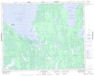
Poplar Point is a Cape located in 3,4-34-3-W, Manitoba and has an elevation of 219 meters.
- Latitude: 51° 53' 53'' North (decimal: 51.8980999)
- Longitude: 97° 49' 46'' West (decimal: -97.8293999)
- Topography Feature Category: Cape
- Geographical Feature: Point
- Canadian Province/Territory: Manitoba
- Elevation: 219 meters
- Location: 3,4-34-3-W
- Atlas of Canada Locator Map: Poplar Point
- GPS Coordinate Locator Map: Poplar Point Lat/Long