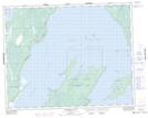
Maps showing Punk Island, Manitoba
Punk Island is a Island located in Manitoba.
- Latitude: 51° 18' 1'' North (decimal: 51.3003000)
- Longitude: 96° 32' 13'' West (decimal: -96.5369000)
- Topography Feature Category: Island
- Geographical Feature: Island
- Canadian Province/Territory: Manitoba
- GPS Coordinate Locator Map: Punk Island Lat/Long
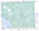
Punk Island NTS Map Sheets