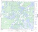
Maps showing Red Earth Lake Control Structure, 54-22-W, Manitoba
Red Earth Lake Control Structure is a Hydraulic construction located in 54-22-W, Manitoba.
- Latitude: 53° 40' 13'' North (decimal: 53.6702999)
- Longitude: 100° 39' 15'' West (decimal: -100.6542000)
- Topography Feature Category: Hydraulic construction
- Geographical Feature: Control Structure
- Canadian Province/Territory: Manitoba
- Location: 54-22-W
- Atlas of Canada Locator Map: Red Earth Lake Control Structure
- GPS Coordinate Locator Map: Red Earth Lake Control Structure Lat/Long
Red Earth Lake Control Structure NTS Map Sheets