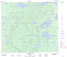
Maps showing Ridge Lake, 85-7-W, Manitoba
Ridge Lake is a Lake located in 85-7-W, Manitoba and has an elevation of 281 meters.
- Latitude: 56° 23' 11'' North (decimal: 56.3864000)
- Longitude: 98° 29' 33'' West (decimal: -98.4924999)
- Topography Feature Category: Lake
- Geographical Feature: Lake
- Canadian Province/Territory: Manitoba
- Elevation: 281 meters
- Location: 85-7-W
- Atlas of Canada Locator Map: Ridge Lake
- GPS Coordinate Locator Map: Ridge Lake Lat/Long
Ridge Lake NTS Map Sheets