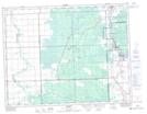
Maps showing River Hills, 22-13-11-E, Manitoba
River Hills is a Unincorporated area located in 22-13-11-E, Manitoba and has an elevation of 269 meters.
- Latitude: 50° 4' 34'' North (decimal: 50.0760999)
- Longitude: 96° 1' 37'' West (decimal: -96.0269000)
- Topography Feature Category: Unincorporated area
- Geographical Feature: Community
- Canadian Province/Territory: Manitoba
- Elevation: 269 meters
- Location: 22-13-11-E
- Atlas of Canada Locator Map: River Hills
- GPS Coordinate Locator Map: River Hills Lat/Long