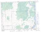
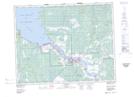
Maps showing Robertsons Point, 36-17-10-E, Manitoba
Robertsons Point is a Cape located in 36-17-10-E, Manitoba.
- Latitude: 50° 30' 00'' North (decimal: 50.4999999)
- Longitude: 96° 5' 17'' West (decimal: -96.0881000)
- Topography Feature Category: Cape
- Geographical Feature: Point
- Canadian Province/Territory: Manitoba
- Location: 36-17-10-E
- Atlas of Canada Locator Map: Robertsons Point
- GPS Coordinate Locator Map: Robertsons Point Lat/Long
Robertsons Point NTS Map Sheets