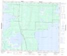
Maps showing Root Lake Indian Reserve 231, Manitoba
Root Lake Indian Reserve 231 is a Indian Reserve located in Manitoba.
- Latitude: 54° 0' 0'' North (decimal: 54.0000000)
- Longitude: 101° 21' 26'' West (decimal: -101.3572000)
- Topography Feature Category: Indian Reserve
- Geographical Feature: Indian Reserve
- Canadian Province/Territory: Manitoba
- GPS Coordinate Locator Map: Root Lake Indian Reserve 231 Lat/Long
Root Lake Indian Reserve 231 NTS Map Sheets