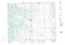
Maps showing Ross Creek, 1-16-3-E, Manitoba
Ross Creek is a River located in 1-16-3-E, Manitoba and has an elevation of 234 meters.
- Latitude: 50° 19' 52'' North (decimal: 50.3310999)
- Longitude: 97° 3' 39'' West (decimal: -97.0607999)
- Topography Feature Category: River
- Geographical Feature: Creek
- Canadian Province/Territory: Manitoba
- Elevation: 234 meters
- Location: 1-16-3-E
- Atlas of Canada Locator Map: Ross Creek
- GPS Coordinate Locator Map: Ross Creek Lat/Long