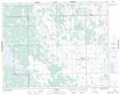
Maps showing Rus Drain, 25-24-2-W, Manitoba
Rus Drain is a Hydraulic construction located in 25-24-2-W, Manitoba and has an elevation of 252 meters.
- Latitude: 51° 6' 10'' North (decimal: 51.1027999)
- Longitude: 97° 36' 43'' West (decimal: -97.6119000)
- Topography Feature Category: Hydraulic construction
- Geographical Feature: Drain
- Canadian Province/Territory: Manitoba
- Elevation: 252 meters
- Location: 25-24-2-W
- Atlas of Canada Locator Map: Rus Drain
- GPS Coordinate Locator Map: Rus Drain Lat/Long