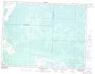
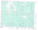
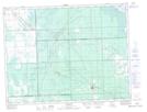
Maps showing St. Labre Creek, 22-6-12-E, Manitoba
St. Labre Creek is a River located in 22-6-12-E, Manitoba and has an elevation of 366 meters.
- Latitude: 49° 30' 4'' North (decimal: 49.5011000)
- Longitude: 95° 54' 10'' West (decimal: -95.9027999)
- Topography Feature Category: River
- Geographical Feature: Creek
- Canadian Province/Territory: Manitoba
- Elevation: 366 meters
- Location: 22-6-12-E
- Atlas of Canada Locator Map: St. Labre Creek
- GPS Coordinate Locator Map: St. Labre Creek Lat/Long
St. Labre Creek NTS Map Sheets