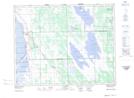
Maps showing St. Laurent, 16-4-W, Manitoba
St. Laurent is a Unincorporated area located in 16-4-W, Manitoba and has an elevation of 249 meters.
- Latitude: 50° 24' 46'' North (decimal: 50.4128000)
- Longitude: 97° 56' 27'' West (decimal: -97.9407999)
- Topography Feature Category: Unincorporated area
- Geographical Feature: Community
- Canadian Province/Territory: Manitoba
- Elevation: 249 meters
- Location: 16-4-W
- Atlas of Canada Locator Map: St. Laurent
- GPS Coordinate Locator Map: St. Laurent Lat/Long