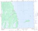
Maps showing St. Patrick Creek, 5-33-1-E, Manitoba
St. Patrick Creek is a River located in 5-33-1-E, Manitoba and has an elevation of 219 meters.
- Latitude: 51° 48' 27'' North (decimal: 51.8075000)
- Longitude: 97° 25' 11'' West (decimal: -97.4197000)
- Topography Feature Category: River
- Geographical Feature: Creek
- Canadian Province/Territory: Manitoba
- Elevation: 219 meters
- Location: 5-33-1-E
- Atlas of Canada Locator Map: St. Patrick Creek
- GPS Coordinate Locator Map: St. Patrick Creek Lat/Long