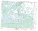
Maps showing Salt Channel Indian Reserve 21D, Manitoba
Salt Channel Indian Reserve 21D is a Indian Reserve located in Manitoba.
- Latitude: 53° 44' 7'' North (decimal: 53.7353000)
- Longitude: 101° 42' 1'' West (decimal: -101.7003000)
- Topography Feature Category: Indian Reserve
- Geographical Feature: Indian Reserve
- Canadian Province/Territory: Manitoba
- GPS Coordinate Locator Map: Salt Channel Indian Reserve 21D Lat/Long
Salt Channel Indian Reserve 21D NTS Map Sheets