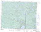
Maps showing Sanders Lake, 30-11-17-E, Manitoba
Sanders Lake is a Lake located in 30-11-17-E, Manitoba and has an elevation of 337 meters.
- Latitude: 49° 56' 54'' North (decimal: 49.9483000)
- Longitude: 95° 15' 38'' West (decimal: -95.2605999)
- Topography Feature Category: Lake
- Geographical Feature: Lake
- Canadian Province/Territory: Manitoba
- Elevation: 337 meters
- Location: 30-11-17-E
- Atlas of Canada Locator Map: Sanders Lake
- GPS Coordinate Locator Map: Sanders Lake Lat/Long