Canada Topographic Maps

Sayers Creek Topo Maps

Topography maps and Latitude/Longitude Location

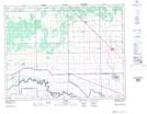
Maps showing Sayers Creek, Manitoba

Sayers Creek is a River located in Manitoba.

  • Latitude: 50° 0' 57'' North   (decimal: 50.0158000)
  • Longitude: 97° 45' 43'' West   (decimal: -97.7618999)
  • Topography Feature Category: River
  • Geographical Feature: Creek
  • Canadian Province/Territory: Manitoba
  • GPS Coordinate Locator Map: Sayers Creek Lat/Long

Sayers Creek NTS Map Sheets

062I04 Warren Topographic Map at 1:50,000 scale

062I Selkirk Topographic Map at 1:250,000 scale

 
Buy Topographic Maps DVD
Newsletter Sign-up

Yes, I want to receive map store discounts.


Bookmark and Share