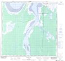
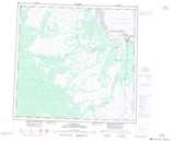
Maps showing Second Burton Rock, Manitoba
Second Burton Rock is a Mountain located in Manitoba and has an elevation of 29 meters.
- Latitude: 58° 44' 5'' North (decimal: 58.7346999)
- Longitude: 94° 16' 40'' West (decimal: -94.2778000)
- Topography Feature Category: Mountain
- Geographical Feature: Rock
- Canadian Province/Territory: Manitoba
- Elevation: 29 meters
- Atlas of Canada Locator Map: Second Burton Rock
- GPS Coordinate Locator Map: Second Burton Rock Lat/Long
Second Burton Rock NTS Map Sheets