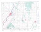
Maps showing Selkirk, St. Clements, Manitoba
Selkirk is a City located in St. Clements, Manitoba and has an elevation of 231 meters.
- Latitude: 50° 8' 37'' North (decimal: 50.1435999)
- Longitude: 96° 53' 2'' West (decimal: -96.8839000)
- Topography Feature Category: City
- Geographical Feature: City
- Canadian Province/Territory: Manitoba
- Elevation: 231 meters
- Location: St. Clements
- Atlas of Canada Locator Map: Selkirk
- GPS Coordinate Locator Map: Selkirk Lat/Long