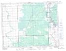
Maps showing Seven Sisters Falls, 27-13-11-E, Manitoba
Seven Sisters Falls is a Unincorporated area located in 27-13-11-E, Manitoba and has an elevation of 267 meters.
- Latitude: 50° 6' 21'' North (decimal: 50.1057999)
- Longitude: 96° 0' 56'' West (decimal: -96.0156000)
- Topography Feature Category: Unincorporated area
- Geographical Feature: Community
- Canadian Province/Territory: Manitoba
- Elevation: 267 meters
- Location: 27-13-11-E
- Atlas of Canada Locator Map: Seven Sisters Falls
- GPS Coordinate Locator Map: Seven Sisters Falls Lat/Long