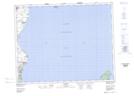
Maps showing Spruce Bay Heights, 9-21-4-E, Manitoba
Spruce Bay Heights is a Unincorporated area located in 9-21-4-E, Manitoba and has an elevation of 217 meters.
- Latitude: 50° 47' 28'' North (decimal: 50.7911000)
- Longitude: 96° 58' 52'' West (decimal: -96.9811000)
- Topography Feature Category: Unincorporated area
- Geographical Feature: Community
- Canadian Province/Territory: Manitoba
- Elevation: 217 meters
- Location: 9-21-4-E
- Atlas of Canada Locator Map: Spruce Bay Heights
- GPS Coordinate Locator Map: Spruce Bay Heights Lat/Long