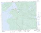
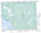
Maps showing Steeprock Creek, 26-9-E, Manitoba
Steeprock Creek is a River located in 26-9-E, Manitoba.
- Latitude: 51° 14' 48'' North (decimal: 51.2466999)
- Longitude: 96° 18' 23'' West (decimal: -96.3064000)
- Topography Feature Category: River
- Geographical Feature: Creek
- Canadian Province/Territory: Manitoba
- Location: 26-9-E
- Atlas of Canada Locator Map: Steeprock Creek
- GPS Coordinate Locator Map: Steeprock Creek Lat/Long
Steeprock Creek NTS Map Sheets