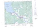
Maps showing The Rock, Manitoba
The Rock is a Unincorporated area located in Manitoba and has an elevation of 222 meters.
- Latitude: 50° 34' 18'' North (decimal: 50.5716999)
- Longitude: 96° 13' 50'' West (decimal: -96.2305999)
- Topography Feature Category: Unincorporated area
- Geographical Feature: Neighbourhood
- Canadian Province/Territory: Manitoba
- Elevation: 222 meters
- Atlas of Canada Locator Map: The Rock
- GPS Coordinate Locator Map: The Rock Lat/Long