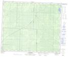
Maps showing Turnberry, 30-51-29-W, Manitoba
Turnberry is a Unincorporated area located in 30-51-29-W, Manitoba and has an elevation of 277 meters.
- Latitude: 53° 26' 10'' North (decimal: 53.4360999)
- Longitude: 101° 42' 58'' West (decimal: -101.7160999)
- Topography Feature Category: Unincorporated area
- Geographical Feature: Community
- Canadian Province/Territory: Manitoba
- Elevation: 277 meters
- Location: 30-51-29-W
- Atlas of Canada Locator Map: Turnberry
- GPS Coordinate Locator Map: Turnberry Lat/Long