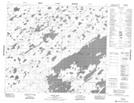
Maps showing Wachask Portage, Manitoba
Wachask Portage is a Road feature located in Manitoba and has an elevation of 178 meters.
- Latitude: 55° 8' 27'' North (decimal: 55.1407999)
- Longitude: 94° 35' 24'' West (decimal: -94.5900000)
- Topography Feature Category: Road feature
- Geographical Feature: Portage
- Canadian Province/Territory: Manitoba
- Elevation: 178 meters
- Atlas of Canada Locator Map: Wachask Portage
- GPS Coordinate Locator Map: Wachask Portage Lat/Long
Wachask Portage NTS Map Sheets