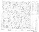
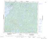
Maps showing Waputonisk Portage, Manitoba
Waputonisk Portage is a Road feature located in Manitoba and has an elevation of 356 meters.
- Latitude: 57° 59' 21'' North (decimal: 57.9891999)
- Longitude: 101° 25' 51'' West (decimal: -101.4308000)
- Topography Feature Category: Road feature
- Geographical Feature: Portage
- Canadian Province/Territory: Manitoba
- Elevation: 356 meters
- Atlas of Canada Locator Map: Waputonisk Portage
- GPS Coordinate Locator Map: Waputonisk Portage Lat/Long