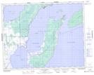
Maps showing Washow Bay, 32-24-4-E, Manitoba
Washow Bay is a Unincorporated area located in 32-24-4-E, Manitoba and has an elevation of 219 meters.
- Latitude: 51° 7' 36'' North (decimal: 51.1267000)
- Longitude: 96° 59' 25'' West (decimal: -96.9902999)
- Topography Feature Category: Unincorporated area
- Geographical Feature: Locality
- Canadian Province/Territory: Manitoba
- Elevation: 219 meters
- Location: 32-24-4-E
- Atlas of Canada Locator Map: Washow Bay
- GPS Coordinate Locator Map: Washow Bay Lat/Long