Canada Topographic Maps

Washow River Topo Maps

Topography maps and Latitude/Longitude Location

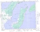
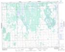
Maps showing Washow River, Manitoba

Washow River is a River located in Manitoba.

  • Latitude: 51° 12' 2'' North   (decimal: 51.2005999)
  • Longitude: 96° 59' 50'' West   (decimal: -96.9971999)
  • Topography Feature Category: River
  • Geographical Feature: River
  • Canadian Province/Territory: Manitoba
  • GPS Coordinate Locator Map: Washow River Lat/Long

Washow River NTS Map Sheets

062P02 Gull Harbour Topographic Map at 1:50,000 scale

062P03 Shorncliffe Topographic Map at 1:50,000 scale

062P Hecla Topographic Map at 1:250,000 scale

 
Buy Topographic Maps DVD
Newsletter Sign-up

Yes, I want to receive map store discounts.


Bookmark and Share