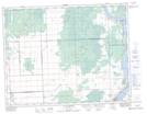
Maps showing Wentland, Manitoba
Wentland is a Unincorporated area located in Manitoba.
- Latitude: 50° 16' 41'' North (decimal: 50.2780999)
- Longitude: 96° 28' 46'' West (decimal: -96.4793999)
- Topography Feature Category: Unincorporated area
- Geographical Feature: Post Office
- Canadian Province/Territory: Manitoba
- GPS Coordinate Locator Map: Wentland Lat/Long
Wentland NTS Map Sheets