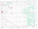
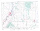
Maps showing West Pine Ridge, 12-4,5-E, Manitoba
West Pine Ridge is a Unincorporated area located in 12-4,5-E, Manitoba and has an elevation of 243 meters.
- Latitude: 49° 59' 45'' North (decimal: 49.9957999)
- Longitude: 96° 54' 39'' West (decimal: -96.9108000)
- Topography Feature Category: Unincorporated area
- Geographical Feature: Community
- Canadian Province/Territory: Manitoba
- Elevation: 243 meters
- Location: 12-4,5-E
- Atlas of Canada Locator Map: West Pine Ridge
- GPS Coordinate Locator Map: West Pine Ridge Lat/Long
West Pine Ridge NTS Map Sheets