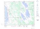
Maps showing West Shoal Lake, 15,16-2-W, Manitoba
West Shoal Lake is a Lake located in 15,16-2-W, Manitoba and has an elevation of 256 meters.
- Latitude: 50° 20' 10'' North (decimal: 50.3360999)
- Longitude: 97° 40' 59'' West (decimal: -97.6830999)
- Topography Feature Category: Lake
- Geographical Feature: Lake
- Canadian Province/Territory: Manitoba
- Elevation: 256 meters
- Location: 15,16-2-W
- Atlas of Canada Locator Map: West Shoal Lake
- GPS Coordinate Locator Map: West Shoal Lake Lat/Long