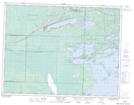
Maps showing Whiteshell Bog, 5,23,35-8-15-E, Manitoba
Whiteshell Bog is a Low vegetation located in 5,23,35-8-15-E, Manitoba and has an elevation of 331 meters.
- Latitude: 49° 40' 11'' North (decimal: 49.6696999)
- Longitude: 95° 26' 15'' West (decimal: -95.4374999)
- Topography Feature Category: Low vegetation
- Geographical Feature: Bog
- Canadian Province/Territory: Manitoba
- Elevation: 331 meters
- Location: 5,23,35-8-15-E
- Atlas of Canada Locator Map: Whiteshell Bog
- GPS Coordinate Locator Map: Whiteshell Bog Lat/Long