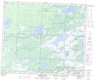
Maps showing Wuskay Creek, 5-57-28-W, Manitoba
Wuskay Creek is a River located in 5-57-28-W, Manitoba.
- Latitude: 53° 54' North (decimal: 53.8999999)
- Longitude: 101° 36' West (decimal: -101.6000000)
- Topography Feature Category: River
- Geographical Feature: Creek
- Canadian Province/Territory: Manitoba
- Location: 5-57-28-W
- GPS Coordinate Locator Map: Wuskay Creek Lat/Long
Wuskay Creek NTS Map Sheets