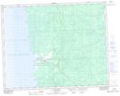
Maps showing Little Black River, 32,33-21-9-E, Manitoba
Little Black River is a Unincorporated area located in 32,33-21-9-E, Manitoba and has an elevation of 218 meters.
- Latitude: 50° 49' 45'' North (decimal: 50.8292000)
- Longitude: 96° 19' 10'' West (decimal: -96.3194000)
- Topography Feature Category: Unincorporated area
- Geographical Feature: Community
- Canadian Province/Territory: Manitoba
- Elevation: 218 meters
- Location: 32,33-21-9-E
- Atlas of Canada Locator Map: Little Black River
- GPS Coordinate Locator Map: Little Black River Lat/Long
Little Black River NTS Map Sheets