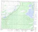
Maps showing Birch Pond, 18-54-26-W, Manitoba
Birch Pond is a Lake located in 18-54-26-W, Manitoba.
- Latitude: 53° 40' 10'' North (decimal: 53.6694000)
- Longitude: 101° 16' 30'' West (decimal: -101.2749999)
- Topography Feature Category: Lake
- Geographical Feature: Pond
- Canadian Province/Territory: Manitoba
- Location: 18-54-26-W
- Atlas of Canada Locator Map: Birch Pond
- GPS Coordinate Locator Map: Birch Pond Lat/Long
Birch Pond NTS Map Sheets