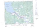
Maps showing St-Georges Pond, 1-18-9-E, Manitoba
St-Georges Pond is a Lake located in 1-18-9-E, Manitoba.
- Latitude: 50° 30' 52'' North (decimal: 50.5143999)
- Longitude: 96° 13' 45'' West (decimal: -96.2292000)
- Topography Feature Category: Lake
- Geographical Feature: Pond
- Canadian Province/Territory: Manitoba
- Location: 1-18-9-E
- Atlas of Canada Locator Map: St-Georges Pond
- GPS Coordinate Locator Map: St-Georges Pond Lat/Long