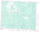
Maps showing Strawberry Pond, 5-8-15-E, Manitoba
Strawberry Pond is a Lake located in 5-8-15-E, Manitoba and has an elevation of 315 meters.
- Latitude: 49° 37' 53'' North (decimal: 49.6314000)
- Longitude: 95° 30' 35'' West (decimal: -95.5096999)
- Topography Feature Category: Lake
- Geographical Feature: Pond
- Canadian Province/Territory: Manitoba
- Elevation: 315 meters
- Location: 5-8-15-E
- Atlas of Canada Locator Map: Strawberry Pond
- GPS Coordinate Locator Map: Strawberry Pond Lat/Long