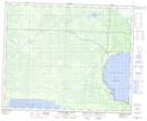
Maps showing Sakwaysew Pond, 31-48-25-W, Manitoba
Sakwaysew Pond is a Lake located in 31-48-25-W, Manitoba.
- Latitude: 53° 11' 18'' North (decimal: 53.1883000)
- Longitude: 101° 5' 35'' West (decimal: -101.0931000)
- Topography Feature Category: Lake
- Geographical Feature: Pond
- Canadian Province/Territory: Manitoba
- Location: 31-48-25-W
- Atlas of Canada Locator Map: Sakwaysew Pond
- GPS Coordinate Locator Map: Sakwaysew Pond Lat/Long
Sakwaysew Pond NTS Map Sheets