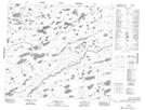
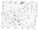
Maps showing Duncan River, 16-79-E, Manitoba
Duncan River is a River located in 16-79-E, Manitoba and has an elevation of 178 meters.
- Latitude: 55° 52' 14'' North (decimal: 55.8706000)
- Longitude: 95° 4' 6'' West (decimal: -95.0682999)
- Topography Feature Category: River
- Geographical Feature: River
- Canadian Province/Territory: Manitoba
- Elevation: 178 meters
- Location: 16-79-E
- Atlas of Canada Locator Map: Duncan River
- GPS Coordinate Locator Map: Duncan River Lat/Long
Duncan River NTS Map Sheets