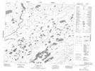
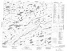
Maps showing Marshall Creek, Manitoba
Marshall Creek is a River located in Manitoba and has an elevation of 187 meters.
- Latitude: 55° 29' 00'' North (decimal: 55.4833000)
- Longitude: 95° 1' 20'' West (decimal: -95.0221999)
- Topography Feature Category: River
- Geographical Feature: Creek
- Canadian Province/Territory: Manitoba
- Elevation: 187 meters
- Atlas of Canada Locator Map: Marshall Creek
- GPS Coordinate Locator Map: Marshall Creek Lat/Long
Marshall Creek NTS Map Sheets