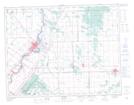
Maps showing Griffiths Hill, 19,20-12-5-E, Manitoba
Griffiths Hill is a Mountain located in 19,20-12-5-E, Manitoba.
- Latitude: 50° 1' 42'' North (decimal: 50.0283000)
- Longitude: 96° 53' 21'' West (decimal: -96.8891999)
- Topography Feature Category: Mountain
- Geographical Feature: Hill
- Canadian Province/Territory: Manitoba
- Location: 19,20-12-5-E
- Atlas of Canada Locator Map: Griffiths Hill
- GPS Coordinate Locator Map: Griffiths Hill Lat/Long