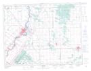
Maps showing Garson Quarry, 4,9-13-6-E, Manitoba
Garson Quarry is a Unincorporated area located in 4,9-13-6-E, Manitoba.
- Latitude: 50° 4' 40'' North (decimal: 50.0778000)
- Longitude: 96° 42' 24'' West (decimal: -96.7066999)
- Topography Feature Category: Unincorporated area
- Geographical Feature: Post Office
- Canadian Province/Territory: Manitoba
- Location: 4,9-13-6-E
- Atlas of Canada Locator Map: Garson Quarry
- GPS Coordinate Locator Map: Garson Quarry Lat/Long