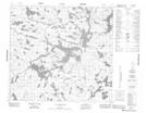
Maps showing Johnston Peninsula, Manitoba
Johnston Peninsula is a Cape located in Manitoba.
- Latitude: 57° 25' 23'' North (decimal: 57.4231000)
- Longitude: 100° 6' 54'' West (decimal: -100.1149999)
- Topography Feature Category: Cape
- Geographical Feature: Peninsula
- Canadian Province/Territory: Manitoba
- Atlas of Canada Locator Map: Johnston Peninsula
- GPS Coordinate Locator Map: Johnston Peninsula Lat/Long
Johnston Peninsula NTS Map Sheets