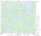
Maps showing Lewis Point, 88-14,15-W1, Manitoba
Lewis Point is a Cape located in 88-14,15-W1, Manitoba.
- Latitude: 56° 37' 52'' North (decimal: 56.6310999)
- Longitude: 99° 42' 15'' West (decimal: -99.7042000)
- Topography Feature Category: Cape
- Geographical Feature: Point
- Canadian Province/Territory: Manitoba
- Location: 88-14,15-W1
- Atlas of Canada Locator Map: Lewis Point
- GPS Coordinate Locator Map: Lewis Point Lat/Long
Lewis Point NTS Map Sheets