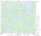
Maps showing Mitchell Bay, 87-14-W1, Manitoba
Mitchell Bay is a Bay located in 87-14-W1, Manitoba.
- Latitude: 56° 33' 36'' North (decimal: 56.5599999)
- Longitude: 99° 39' 0'' West (decimal: -99.6500000)
- Topography Feature Category: Bay
- Geographical Feature: Bay
- Canadian Province/Territory: Manitoba
- Location: 87-14-W1
- Atlas of Canada Locator Map: Mitchell Bay
- GPS Coordinate Locator Map: Mitchell Bay Lat/Long
Mitchell Bay NTS Map Sheets