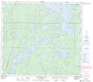
Maps showing McLeod Point, 88,89-14-W1, Manitoba
McLeod Point is a Cape located in 88,89-14-W1, Manitoba.
- Latitude: 56° 41' 15'' North (decimal: 56.6874999)
- Longitude: 99° 38' 00'' West (decimal: -99.6333000)
- Topography Feature Category: Cape
- Geographical Feature: Point
- Canadian Province/Territory: Manitoba
- Location: 88,89-14-W1
- Atlas of Canada Locator Map: McLeod Point
- GPS Coordinate Locator Map: McLeod Point Lat/Long
McLeod Point NTS Map Sheets