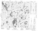
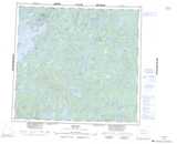
Maps showing Kelly Bay, Manitoba
Kelly Bay is a Bay located in Manitoba.
- Latitude: 57° 13' 24'' North (decimal: 57.2232999)
- Longitude: 100° 55' 42'' West (decimal: -100.9283000)
- Topography Feature Category: Bay
- Geographical Feature: Bay
- Canadian Province/Territory: Manitoba
- Atlas of Canada Locator Map: Kelly Bay
- GPS Coordinate Locator Map: Kelly Bay Lat/Long
Kelly Bay NTS Map Sheets