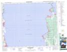
Maps showing Dinner Creek, 14,23,26,27,28,32,33-18-7-E, Manitoba
Dinner Creek is a River located in 14,23,26,27,28,32,33-18-7-E, Manitoba.
- Latitude: 50° 34' 54'' North (decimal: 50.5817000)
- Longitude: 96° 35' 2'' West (decimal: -96.5838999)
- Topography Feature Category: River
- Geographical Feature: Creek
- Canadian Province/Territory: Manitoba
- Location: 14,23,26,27,28,32,33-18-7-E
- Atlas of Canada Locator Map: Dinner Creek
- GPS Coordinate Locator Map: Dinner Creek Lat/Long
Dinner Creek NTS Map Sheets