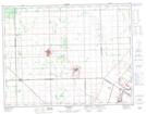
Maps showing Lilyfield, 8,16-12-2-E, Manitoba
Lilyfield is a Unincorporated area located in 8,16-12-2-E, Manitoba and has an elevation of 242 meters.
- Latitude: 50° 0' 17'' North (decimal: 50.0046999)
- Longitude: 97° 16' 33'' West (decimal: -97.2758000)
- Topography Feature Category: Unincorporated area
- Geographical Feature: Locality
- Canadian Province/Territory: Manitoba
- Elevation: 242 meters
- Location: 8,16-12-2-E
- Atlas of Canada Locator Map: Lilyfield
- GPS Coordinate Locator Map: Lilyfield Lat/Long