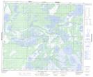
Maps showing Red Rock Ecological Reserve, 53,54-22-W1, Manitoba
Red Rock Ecological Reserve is a Conservation area located in 53,54-22-W1, Manitoba.
- Latitude: 53° 37' 31'' North (decimal: 53.6253000)
- Longitude: 100° 38' 19'' West (decimal: -100.6386000)
- Topography Feature Category: Conservation area
- Geographical Feature: Ecological Reserve
- Canadian Province/Territory: Manitoba
- Location: 53,54-22-W1
- Atlas of Canada Locator Map: Red Rock Ecological Reserve
- GPS Coordinate Locator Map: Red Rock Ecological Reserve Lat/Long
Red Rock Ecological Reserve NTS Map Sheets