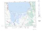
Maps showing Stephenson Point, 3 - 18 - 4E, Manitoba
Stephenson Point is a Cape located in 3 - 18 - 4E, Manitoba.
- Latitude: 50° 29' 30'' North (decimal: 50.4916999)
- Longitude: 96° 57' 10'' West (decimal: -96.9527999)
- Topography Feature Category: Cape
- Geographical Feature: Point
- Canadian Province/Territory: Manitoba
- Location: 3 - 18 - 4E
- Atlas of Canada Locator Map: Stephenson Point
- GPS Coordinate Locator Map: Stephenson Point Lat/Long
Stephenson Point NTS Map Sheets